The Los Angeles District Mega Projects Division oversees four dam safety projects: Whittier Narrows, Prado, Carbon Canyon and Mojave River dams.
Whittier Narrows Dam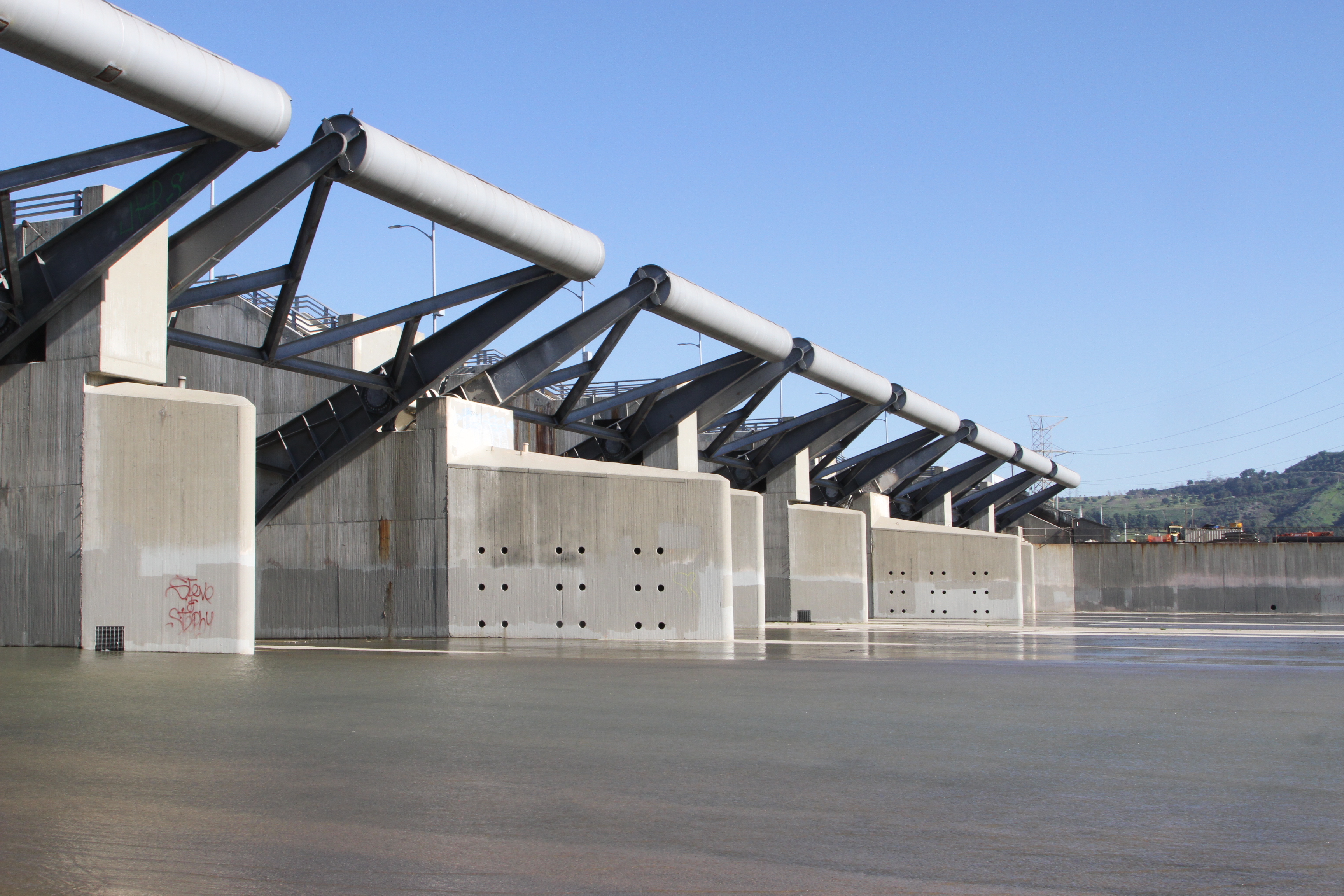
Whittier Narrows Dam is a three-mile-long dam and the central element of the Los Angeles County Drainage Area Flood Control System. The dam is located 11 miles east of Los Angeles and protects 1.25 million people in 25 cities and unincorporated communities downstream of the dam. The dam has a Dam Safety Action Classification of 1, representing an extremely high incremental risk due to the potential for significant loss of life and economic damages should a failure of the dam occur.
To address these risks, the U.S. Army Corps of Engineers developed an improvement plan that includes relocation of five utilities located in two galleries near the San Gabriel River, completion of environmental commitments, and the dam safety modification itself, including overtopping protection, installation of seepage features, and relocation of utilities and two roads (Rosemead Boulevard and Lincoln Avenue), currently at 95 percent design.
Whittier Narrows Dam was authorized by the Flood Control Act of 1937 (PL-75-194, covering the Los Angeles County Drainage Area), the Flood Control Act of 1941 (San Gabriel River Basin), the Flood Control Act of 1944 (Recreation Authorization) and the Flood Control Act of 1950 (additional funds for San Gabriel River Basin).
View our page on the Whittier Narrows Dam Safety Modification Project HERE.
Pr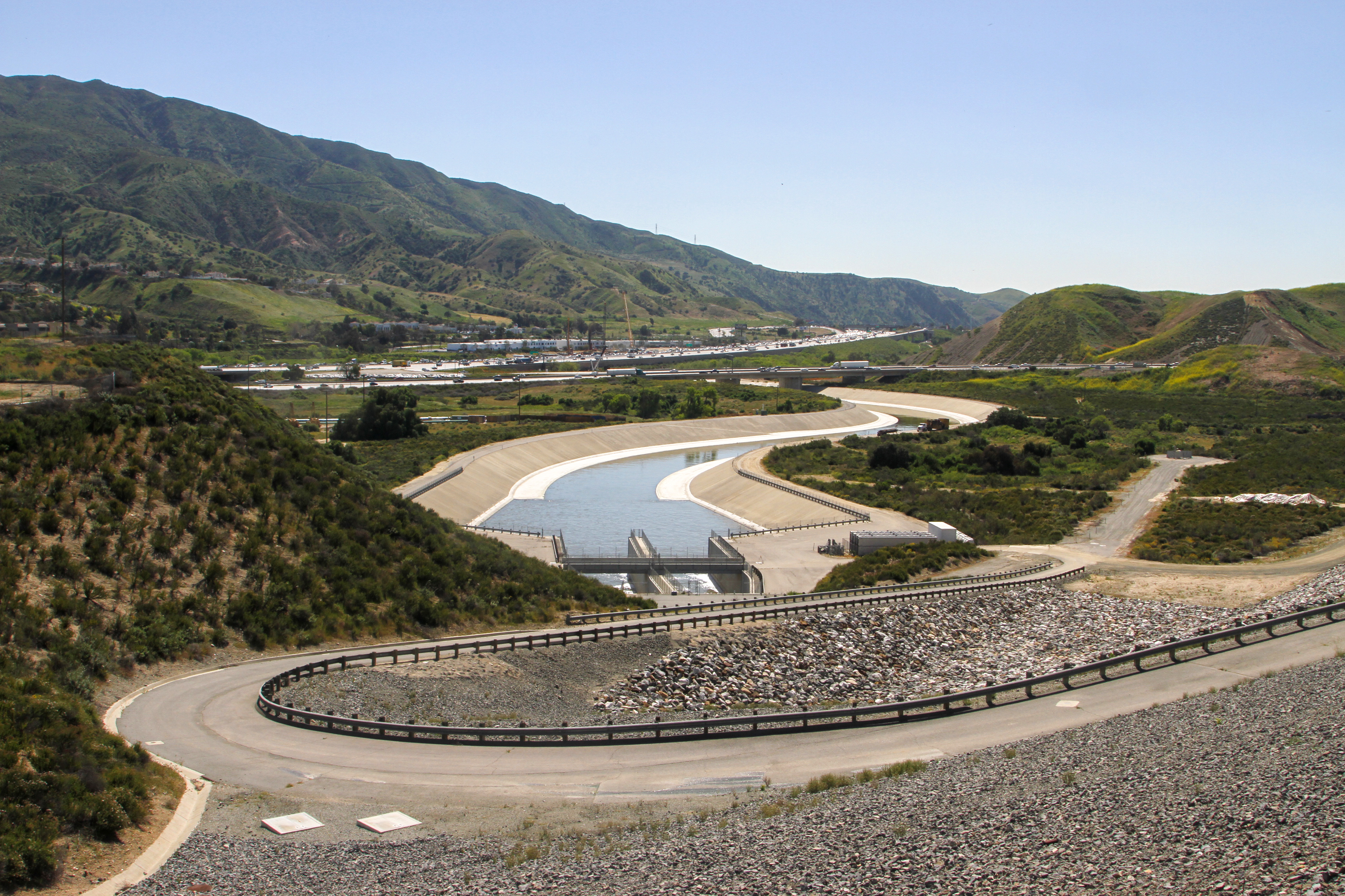 ado Dam
Prado Dam is a flood-risk management project constructed, owned and operated by the U.S. Army Corps of Engineers Los Angeles District. The dam is located in Riverside County, California, approximately two miles west of Corona, and on the lower Santa Ana River approximately 30.5 miles upstream from the confluence with the Pacific Ocean. The Prado Dam and Reservoir serve as the principal regulating structure on the Santa Ana River and covers more than 11,500 acres; 4,100 acres of which are riparian habitat; 4,823 acres are recreation areas; and 2,400 acres are owned by the Orange County Water District. USACE owns 9,100 acres in the basin. The primary authorized purpose of this project is flood-risk management, followed by authorization for recreation and water conservation.
As originally designed, the Prado reservoir below the existing spillway crest elevation of 543 feet, NGVD29, has a gross storage capacity of 217,000 acre-feet, of which a volume of 205,000 acre-feet is utilized for temporary storage of flood runoff and the remaining 12,000 acre-feet for sediment accumulation over a 50-year period.
Since its construction completion in May 1941, the project has adequately performed its primary authorized purpose of flood-risk management. The original project features were in excellent operating condition; however, project modifications were necessary to address flood-risk management deficiencies resulting from a combination of increase in runoff sediment accumulation, change to severity of design rainfall, and the general impacts to the reservoir due to urbanization over much of the valley since 1939. Completing modifications to original project features, which include raising the dam embankment, installation of a new larger-capacity outlet works and raising the existing spillway, will allow the project to maintain its original project purposes.
View our page on Prado Dam HERE.
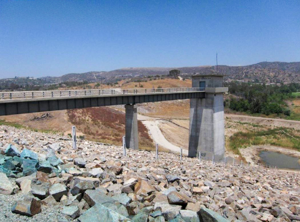 Carbon Canyon Dam
Carbon Canyon Dam is a high-hazard-potential dam currently categorized as Dam Safety Action Classification 2 (high urgency). The Issue Evaluation Study, or IES, for Carbon Canyon Dam was presented to the Dam Senior Oversight Group on July 28, 2020. The New Orleans District Cadre and Los Angeles District completed the IES in accordance with Engineer Regulation 1110-2-1156. Headquarters USACE endorsed performing a Dam Safety Modification Study, or DSMS, to develop alternatives to address internal erosion along the conduit and wastewater line.
The purpose of the DSMS is to identify and recommend a risk management plan that reduces risks posed by actionable potential failure modes, or PFMs, at Carbon Canyon Dam to a tolerable level. A Potential Failure Mode Analysis, or PFMA, and Quantitative Risk Assessment, or QRA, were performed during the IES. It was determined that the incremental risks are primarily driven by the potential for concentrated leak erosion along the conduit (PFM O-3) and by the potential for concentrated leak erosion along the wastewater line (PFM O-3a). The next highest dam safety concern is related to concentrated leak erosion through cracks in the dam crest asphalt road near the left abutment (PFM E-12), but this PFM contributed less than 1 percent to total APF. Overtopping and breach (PFM E-01) is not considered a risk driver because the PMF maximum pool elevation is 6.6 feet below the top of the dam. Seismic potential failure modes were judged to be non-risk drivers.
Carbon Canyon Dam was authorized pursuant to two acts of Congress. The first of these, the Flood Control Act of 1936 (Public Law 738, 74th Congress, H.R. 8455, approved June 22, 1936), provided in part for the construction of reservoirs and related flood-control works for the protection of metropolitan Orange County, California. The second (Public Law 761, 75th Congress, approved June 28, 1938), amended the 1936 act by providing for the acquisition by the U.S. of land, easements and right-of-way for dam and reservoir projects, channel improvements, and channel rectification for flood control.
Mojave River Dam
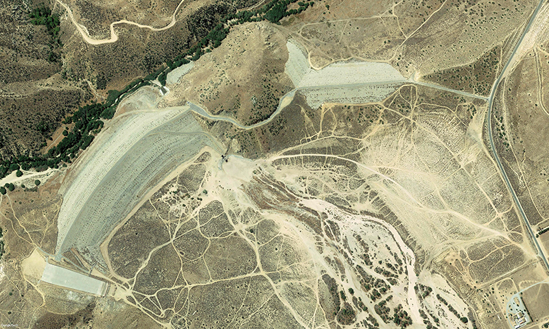 The Mojave River Dam is a high-hazard-potential dam located on the Mojave River in San Bernardino County, California, approximately five miles south of Hesperia and just downstream (north) of the confluence of the West Fork Mojave River and Deep Creek. The dam has a Dam Safety Action Classification of 2, representing a high incremental risk due to the potential for significant loss of life and economic damages should a failure of the dam occur.
The Periodic Assessment was completed and presented to the Dam Senior Oversight Group in July 2019. The U.S. Army Corps of Engineers endorsed the DSAC 2 rating in October 2020. A Quantitative Risk Assessment was also completed and presented to the DSOG in October 2022, and USACE endorsed the DSAC 2 move to the Dam Safety Modification Study in December of that year.
The primary deficiencies identified were the potential for overtopping of the dam and the breach of the main embankment. The incremental risks posed by the project are considered not tolerable.
The Mojave River Dam project was authorized by Congress, (Flood Control Act of 1960, Public Law 86-645) July 14, 1960, authorizing the construction of certain public works on rivers and harbors for flood control and other purposes. The specific authorization for the project is found in Sec. 203 of PL 86-645.
View our page on the Mojave River Dam HERE.