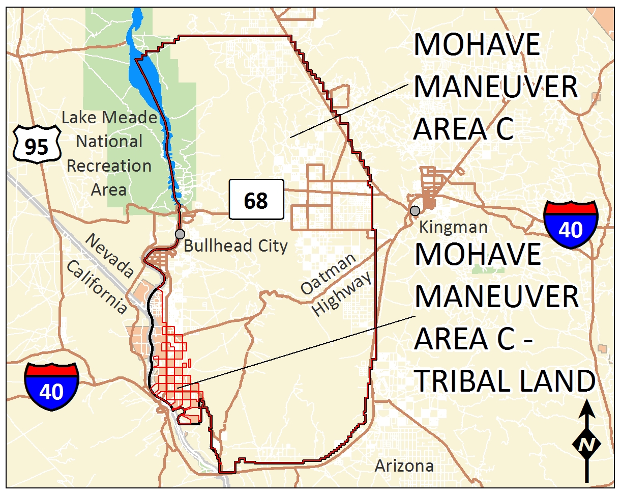
 The Mohave Maneuver Area C Formerly Used Defense Site or FUDS comprises approximately 781,452 acres in the western portion of Mohave County, Arizona. The property is generally bounded by the Colorado River to the west; Kingman, Arizona to the east; Topock, Arizona to the south; and Chloride, Arizona to the north. The Mohave Maneuver Area C FUDS boundary overlaps a portion (21,833 acres) of the Fort Mojave Indian Reservation in Arizona. The Army Corps of Engineers is conducting notification and safety education through the FUDS Program for munitions and explosive hazards that may remain from previous military training activities.
Fort Mojave was established along the Colorado River in 1859 to protect settlers migrating from the east. The camp was abandoned during the Civil War before becoming a military reservation in 1870. Fort Mojave was transferred to the Department of the Interior in 1879.
In April 1944, the U.S. War Department established the Desert Training Center (later renamed the California Arizona Maneuver Area) in an area that extended approximately 100-miles by 200-miles in the deserts of California, Arizona, and Nevada. The Mohave Maneuver Area C portion of the training center was designated as being used for river crossings, a maneuver area, and as a communications zone. In April 1944, training at the California Arizona Maneuver Area ended and the Mohave Maneuver Area C land was relinquished.
Most of the former Mohave Maneuver Area C was reacquired in May 1964 for Operation Desert Strike, a military training exercise that included maneuvers and river crossings with no live fire. Historical records indicate that the portions of Mohave Maneuver Area C used for Operation Desert Strike were between the Black Mountains and the Colorado River; south of Davis Dam and north of the Topock marsh area. Smoke and exploding simulators were used to simulate attacks during the two-week exercise.
The U.S. Army Corps of Engineers began investigating the former maneuver area in 1993 through the FUDS Program. Since that time, the Army Corps of Engineers completed a Site Inspection, which only identified munitions debris from .50 caliber ammunition. In addition, the Fort Mojave Tribe has completed a number of investigations, which have identified small arms and a few munitions items within the tribal lands of Mohave Maneuver Area C. The Army Corps of Engineers continues to investigate Mohave Maneuver Area C to determine if clearance activities are required.