Channel Islands Harbor, California


General Information
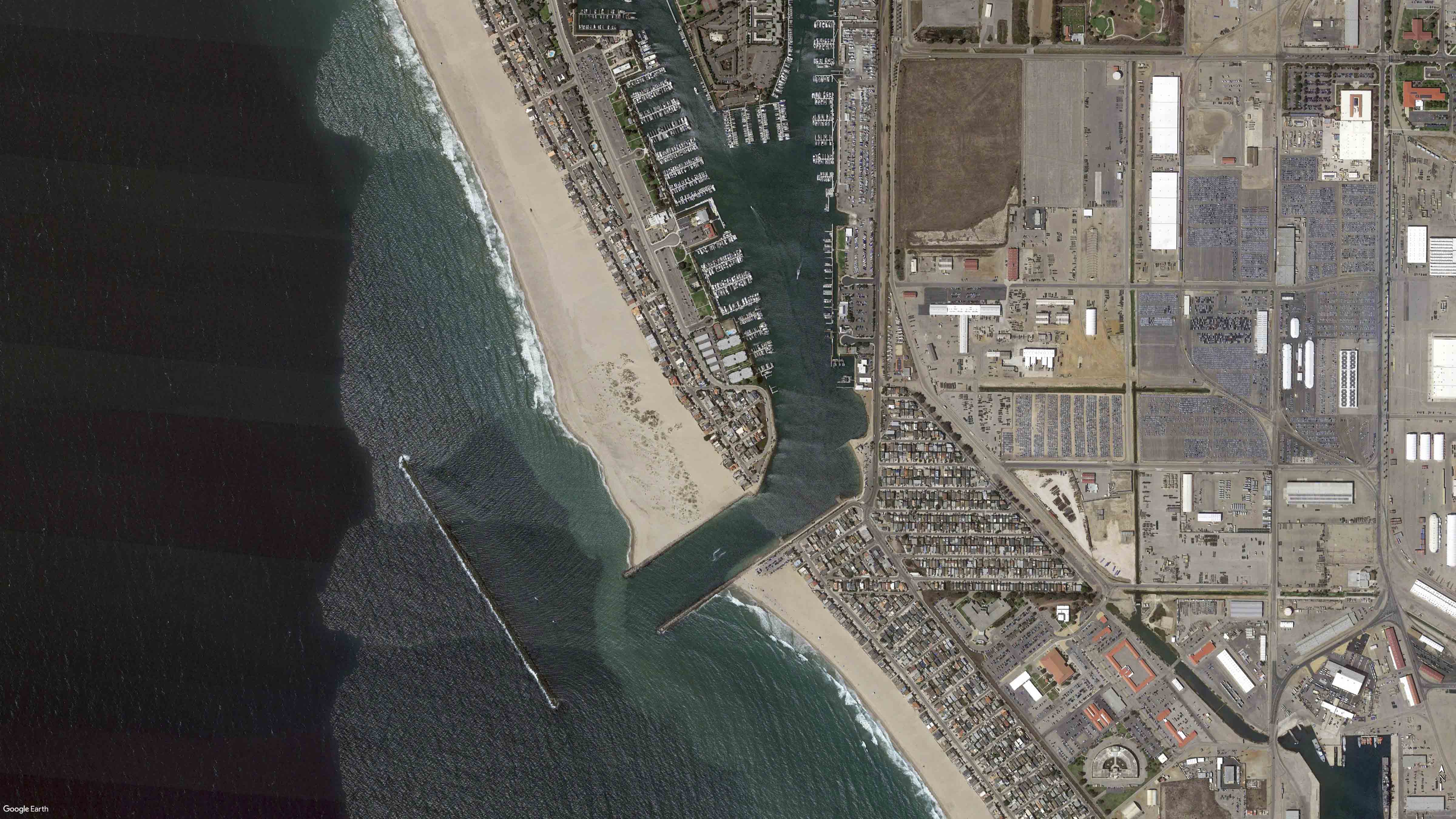
Channel Islands Harbor is located in the city of Oxnard. Dredging for the Channel Islands Harbor began in the mid-1950’s. The harbor was completed in 1963. The harbor was designed to lessen the effect of down-shore beach erosion at Port Hueneme and beyond to Point Mugu. Harbor structural features consist of a 2,300-foot-long offshore breakwater, entrance jetties and an entrance channel leading to the harbor interior. The entrance channel is authorized at a depth of -20 feet mean lower low water (MLLW).

The offshore breakwater and jetties form a sand trap, and the entrance basin collects littoral drift as it moves downcoast. The harbor was designed to trap sand to prevent loss to the submarine canyon off of Port Hueneme and to provide dredged material for beach replenishment for downcoast beaches.


Frequently Asked Questions

Channel Islands & Port Hueneme Harbors Maintenance Dredging Project – Dune Habitat Restoration


1. Why is the U.S. Army Corps of Engineers (Corps) planning to conduct dune habitat restoration on Hollywood Beach?
The restoration effort aims to offset impacts of federal maintenance dredging on the threatened western snowy plover and endangered California least tern -species protected under the Endangered Species Act - and sensitive dune habitat. Maintenance dredging is essential for keeping harbor inlets navigable and sustaining downcoast beaches. However, it affects these species and their habitat, particularly at Channel Islands Harbor. The harbor’s north entrance jetty and detached breakwater trap sand, creating a widened beach and coastal foredune habitat used by the plover and tern. Dredging disrupts these areas and adversely affects designated critical habitat for the plover. To address these effects, the Corps consulted with the U.S. Fish and Wildlife Service under section 7 of the Endangered Species Act. This led to a biological opinion requiring the development and implementation of a dune restoration plan. Additionally, the California Coastal Commission conditionally concurred with the Corps’ consistency determination under section 307 of the Coastal Zone Management Act, which also requires the development and implementation of a dune restoration plan.

2. Will the restoration plan utilize herbicides?
No, there will be no use of herbicides.

3. Where would the dune habitat restoration occur?
The restoration will take place on public lands (see map below)


4. Why is the dune habitat restoration occurring on Hollywood Beach instead of other beaches?
Hollywood Beach is within the maintenance dredging impact area, and restoration efforts here would support species affected by dredging operations by providing replacement nesting and foraging habitat.


5. What type of dune habitat restoration is proposed?
The restoration will enhance and establish coastal dune habitat, incorporating low-profile dunes ranging from 0.5 to 4 feet in height and sparse native vegetation.


6. What type of fencing would be installed and why is it needed?
Low-profile posts/stakes and rope, along with educational signage, will be installed to inform the public and help prevent trampling of restored sensitive habitat.

7. Will this fencing block access to the beach?
The fencing serves a symbolic purpose rather than a restrictive one. Designed with openings, it allows for pedestrians to move freely through the restoration area, maintaining alignment with existing access routes from public streets to the beach.

8. Will the Corps be holding a public outreach to discuss the plan?
The Corps is organizing a public outreach event to discuss the restoration plan. The date for this event is still being determined.

Map of project area.